Friday, 29 July 2011

Resources: Emergency Events Database


"The main objective of the database is to serve the purposes of humanitarian action at national and international levels. It is an initiative aimed to rationalize decision making for disaster preparedness, as well as providing an objective base for vulnerability assessment and priority setting.

EM-DAT contains core data on the occurrence and effects of over 18,000 mass disasters in the world from 1900 to present. The database is compiled from various sources, including UN agencies, non-governmental organisations, insurance companies, research institutes and press agencies."

The database contains records of many geological and atmospherical hazards, as well as other hazards (disease, technological etc). It has data for all continents, and spans over 110 years. Analysis of data for specific regions and areas may produce interesting trends useful for disaster preparedness.  

Wednesday, 27 July 2011

The Politics of Earthquakes

Let me draw your attention to a very interesting and thought-provoking article published by The Los Angeles Times, and written by Claire Berlinksi. The article, The Politics of Earthquakes, outlines how corruption, law enforcement and politics can significantly influence the impact of an earthquake on a major urban area. As Berlinksi writes, "seismic risk mitigation is the greatest urban policy challenge the world confronts today."

The article highlights the huge seismic risk to many of the world's largest cities - cities such as Tehran, Istanbul, Lima, Islamabad, Mexico City and Kathmandu. Cities which are undergoing rapid (and often uncontrolled) urbanisation. It is often stated that the way to reduce risk in these cities is to promote economic development - seismic-proofing a city costs money, and thus is not a possibility for less economically developed countries. 

However, the article points out the vast differences between Turkey and Chile - with similar GDP per capita. A massive M8.8 earthquake struck Chile in 2010, outside the city of Concepcion, leaving 521 dead. While any death toll is tragic, Chile's commendable preparedness and enforcement of building standards meant this was not significantly higher. Berlinkski, however reports that the situation in Turkey is very different. Despite their GDP per capita being very similar, preparedness is not at the same level. There is neither the same structural soundness of buildings, enforcement of building regulations or public awareness campaigns.

Reducing the impacts of earthquakes and other hazards, therefore, is not simply a case of economic development. There is also a huge need to tackle corruption, have good urban planning, enforce building regulation and lead better preparedness campaigns. There is a big responsibility on (a) national and regional governments to enforce regulation and coordinate preparedness measures, (b) international governments to lobby those countries at risk and promote safe urban expansion and disaster risk reduction, (c) local communities to respond willingly and effectively to government measures, not to encourage corruption and to take responsibility for preparing their household.

Monday, 25 July 2011

Crisis in the Horn of Africa (3) - OCHA Update

UNOCHA have published an updated report on the crisis in East Africa - outlining the remaining financial needs, the number of people affected and the response in the affected regions. Figures suggest the number of people affected has grown by over 800,000 in a week. 

Whilst there are many aspects of this crisis, the emergency response required and the long-term development needed that are not directly related to the work of geoscientists. Geologists are involved in some aspects, as outlined in other posts written on this crisis. Development and humanitarian work need a holistic, multi-disciplinary approach. For example, the hydrogeologist needs to work closely with the refugee specialist, water engineer, health worker and many others when working on new boreholes for the expanding refugee camps. Geology for Global Development will therefore continue to use its resources to raise the profile of this crisis situation 

Further Reading

Friday, 22 July 2011

Earthquake Risk: Central Asia

Central Asia (Source: Wikipedia)
This week a Magnitude 6.1 earthquake struck the Ferghana Valley region of Central Asia, killing 13 people in Uzbekistan and injuring many others. Areas in neighbouring Kyrgyzstan and Tajikistan also reported damage. The Ferghana Valley region is one of the most densely populated regions of Central Asia, and one of the most seismically active regions in the world. This combination of seismic hazard and dense population means there is a significant risk of a serious disaster in this area. Historically there have been significant earthquakes in most of the Central Asian nation's capital cities - causing significant damage and leaving many homeless.

The extent of any future disaster will depend on the vulnerability of communities. For example in 2010 large earthquakes struck both Haiti and Chile - and yet the death toll in Chile was substantially lower than in Haiti (despite the Chilean earthquake being significantly stronger). This was as a result of high vulnerability in Haiti compared to Chile, which is much better prepared for earthquakes, has better response mechanisms in place and better quality of buildings. Vulnerability in many cities in Central Asia is high - with dense population, poor earthquake education, poor governmental response mechanisms and low building standards. When this is coupled with the serious probability of hazard in the area (an estimate stated in 1996 suggested there was a 40% chance that a Magnitude 9.0 earthquake will hit Central Asia within 20 years) this area must be a priority area for disaster risk reduction programmes. 

Sarez Lake (Source: Wikipedia)
In addition to the risk to large cities in the region, there is also the possibility of a major multi-hazard event in the border regions/Ferghana Valley. If an earthquake were to cause failure of the landslide formed Sarez Lake - it could lead to catastrophic flooding in the terrain immediately below the lake. This series of events could significantly effect millions of people.

Possible Action?

There is an urgent need for a widespread disaster risk reduction programme in this region. There should be political engagement at the national and regional level, and a building up of the institutional capacity of country's disaster response and preparedness departments (including an examination of insurance against disaster). There should be a strengthening of public education, through the engagement of civil society organisations, the school system and national advertising campaigns. In the long-term there should be a major review of construction quality in the region to reduce the impacts of disasters. 

Further Reading
- UNISDR - Central Asia & Caucasus Disaster Risk Management Initiative (Some good profiles on individual countries, as well as a look at cross-border issues) 

Wednesday, 20 July 2011

Stay Informed...

Geology for Global Development is now on Facebook... 'Like' us now for the latest news, updates and photos from GfGD. 

Don't forget you can also follow us on Twitter (@Geo_Dev) and subscribe to this blog (see link to right). 

Finally why not bookmark our website - www.gfgd.org - and keep informed with what we're doing to raise the profile of international development within the student and recent graduate geosciences community, fight poverty and improve lives around the world.


Monday, 18 July 2011

Newswatch - July 2011

Newswatch is a regular round up of some key stories relating to the geosciences in international development. In the past Newswatch has examined stories relating to geohazards, and in particular landslides. This month there have been a number of geoscience-related things in the news that are well worth a mention:

Mount Lokun (Source: Wiki)
Thousands of people have been evacuated on the island of Sulawesi, in Indonesia. An evacuation zone has been established, affecting around 28,000 people, some of whom have begun to evacuate. There are reports of one fatality (a woman had a heart attack during the evacuation process) and forest fires as a result of the eruption. Indonesia has many active volcanoes, which have caused many fatalities and disruption when erupting in the past. Mount Merapi, for example, killed more than 350 people when it erupted last year. The Jakarta Globe has regular updates on the situation and The Guardian Natural Disasters page also has more details. 


July sees the beginning of the monsoon season in Bangladesh - in which there is routine flooding and displacement of communities. These striking images by NASA show the increase in water in the north of the country. Increased precipitation is likely to result in landslides as well. 


An article written in the past week suggests there have been significant problems in communication between scientists and decision makers following the drought in East Africa. Forecasters issued warnings about very poor rainy seasons, and yet the region has found itself in significant turmoil. It is also suggested that the international community as a whole failed to respond in the provision of funds so that humanitarian organisations could prepare and respond effectively. Meanwhile, there is still a significant crisis in the region and a shortfall of funds. The UK has pledged over £52million more, and is calling on the international community to do more to avoid a catastrophe in the region. The UK public have donated a fantastic £13million through the Disasters Emergency Committee. There is some indication that the drought is also affecting Tanzania more than reported too as they impose power rationing to conserve water in their hydro-electric schemes.

Figures suggest that the first two quarters of 2011 have been the costliest, in terms of losses from natural hazards, on record. The huge economic cost of the earthquake and tsunami in Japan has resulted in losses from the first two quarters of 2011 exceeding the total annual cost of the previous highest year, in 2005. The number of fatalities, however, is below the 2001-2010 average. 


Wednesday, 13 July 2011

Resources: Global Risk Data Platform

The Global Assessment Report 2011 website is hosting an interesting interactive tool for those working on disaster risk reduction and analysis of geological and atmospheric hazards. The Global Risk Data Platform allows you to zoom to anywhere in the world and see overlay maps for actual events, hazard probabilities, and risk probabilities. Events outlined, include hazards such as landslides, earthquakes, volcanic events, fires, floods and droughts (although they are not all available for all aspects of the program). It also allows maps to be printed and e-mailed, and data to be downloaded and put into GIS programs.

The tool aims to share spatial data information on risk from natural hazards. A first glance evaluation suggests it would be useful for giving an overall look at regions of countries, and help development professionals understand some of the risks posed to an area. Its limitations are the resolution at which data can be provided, and the 'single-hazard' approach it takes rather than a 'multi-hazard' approach. There is a 'multiple risk' map, although it is unclear how this is calculated, does not incorporate some major hazards etc.  

Landslide Risk in Chile: Produced on Global Risk Data Platform

Despite its limitations, I'd definitely recommend people explore this tool and see if is beneficial to them as a first stage review of an area, before more detailed hazard analysis is done. I look forward to exploring its potential in time, and seeing what it can produce. 

Monday, 11 July 2011

NEW WEBSITE - www.gfgd.org

GEOLOGY FOR GLOBAL DEVELOPMENT is delighted to announce the launch of its new website:


Why not check it out today!

Thanks for reading our blog, Geology for Global Development, examining some of the ways in which geologists can contribute to fighting poverty and improving lives. From working on clean water resources, to improving agricultural productivity, modeling natural hazards and helping communities adapt and prepare to improving infrastructure - geologists have a significant role to play in international development.

As mentioned in a post back in May I am currently working on establishing an organisation, Geology for Global Development, that  will work to promote global development to student and recent graduate geologists, as well as others in the field. Geology for Global Development will work to inform and engaging people in the key discussions and debates, provide  opportunities for people to use their skills to alleviate poverty, train others and develop resources for NGOs and their overseas partners. It will also work to promote the role of geologists, their skills and knowledge to NGOs and other development organisations.

I am delighted to launch our new website at www.gfgd.org where you can read more about our work and vision, see our latest blog posts and get in touch with us. Please do check it out and if you would like to get more information then fill in the details on the 'Join Us' page. Our blog will still be posted on this site - although you can get links to all the latest posts direct from our new website.

Thanks for your support,

Joel Gill
Director, Geology for Global Development

Thursday, 7 July 2011

Crisis in the Horn of Africa (2) - Long-Term Development

As outlined in Part 1 of this post, there are urgent and immediate needs in the Horn of Africa as millions face starvation and a humanitarian crisis. However there must also be discussion about how to avoid this level of crisis in the future, how to reduce and mitigate the hazard, reduce vulnerability and increase resilience. This post does not aim to provide a comprehensive solution to the problem, but contribute to the discussion with some of the key roles geologists can play in bringing long-term development.

(1) Causes of the Crisis 

There are a number of reports about this hazard being a result of climate change, others say it is related to corruption and poor governance, and others that it is to do with conflict. 

Conflict and poor governance in the region has most certainly increased vulnerability to hazards. For example, conflict in Somalia has resulted in a significant number of people displaced, and governance in regions of Somalia is virtually non-existent. Limited humanitarian access has also exacerbated the problem. Vulnerability due to poor economic development also plays a role, with limited infrastructure, problems with trade and a lack of good irrigation systems using groundwater resources. 

In terms of climate change, GfGD is wary about attributing anything and everything to human induced climate change without sufficient evidence. The Guardian, perhaps irresponsibly, wrote an article with the title "Drought in East Africa the Result of Climate Change and Conflict" while stating in the actual text that 'how far the current conditions.... can be attributed to climate change is not clear." The Guardian state that the latest IPCC report suggests this region will become wetter, where as other research suggests it may increase drought in the region. A joint publication by the Overseas Development Institute and British Geological Survey (Calow & MacDonald, 2009) draws some conclusions about the potential effects of climate change on Africa. These conclusions are that: -
  • Average temperatures are likely to increase.
  • Annual rainfall is likely to decrease in Sub-Saharan Africa and the northern Sahara and increase in the Ethiopian highlands - although these predictions are much harder to make.
  • Rainfall is likely to become increasingly unpredictable in terms of both intensity and duration, with increases in the frequency of extreme events (droughts and floods).
The report does highlight however, that it is much easier to model future temperature changes than rainfall. It is therefore possible that there are links between the crisis in East Africa and a changing climate, though I find it difficult to justify the title of The Guardian's article, and an outright statement that this IS as a result of climate change. 

Finally, there is a wider question about food security, access to markets, infrastructure and agricultural development. Harvests have failed because of lack of rainfall. Farmers used to know when the rain would come, and could plan accordingly - however two years of unpredictable and low rainfall has resulted in failed harvests. When food is grown, there is difficulties in getting it to markets - lack of infrastructure means that people are restricted to very local markets.     
  
In conclusion, the crisis can not be pinned upon one factor or another - it is a complex situation, which requires a number of solutions in order to avoid the repeated and cyclic crisis in this region.

(2) Reducing Vulnerability

I am cautious about using the word 'solutions' - but there are a number of things that can be done to reduce the vulnerability of people and increase their resilience. First and foremost must be a real drive to bring long-term peace to the region, build effective and good government and end corruption that robs the people of the long-term economic development they deserve. There must also be investment in infrastructure, agricultural solutions and improved access to groundwater - there is a role for geologists in all of these areas, working alongside many other professionals and stakeholders.


  (a) Infrastructure - As outlined in an earlier post, geologists play an important role in infrastructure, especially within transport networks (roads, airstrips, railways etc). Improvements in infrastructure in these countries can ensure products get to market as well as the distribution of food to more rural and pastoral areas. Infrastructure is an expensive development project, but essential to improving economic growth and development in the region. 

  (b) Agriculture - In terms of agriculture, there are a number of ways in which geologists can contribute to problems of soil erosion, loss of soil moisture content and lack of essential minerals in the soil. Natural rock resources can be used to provide essential nutrients to the soils, which are often deficient in phosphorous. Many rocks contain phosphorous minerals, which can be added to the soil as a local fertiliser. The addition of rocks such as scoria (or pumice) can help improve the soil's ability to retain water. This rock reduces evaporation from the soil, while allowing water to permeate through into the soil. Preliminary experiments in Ethiopia found this to improve crop yields significantly. Scoria on the soil surface may also offer protection from soil erosion by wind and rain, retaining the fertile topsoil.

  (c) Water Resources - Drilling boreholes to access groundwater is expensive, however in times of drought it is groundwater that proves to be most reliable - often offering access to clean and safe water throughout the year. Reluctance to use groundwater and drill boreholes is often as a result of the expense involved, and concerns that they are not sustainable, involving advanced technology. Indeed, there are too many boreholes that are disused and broken. Groundwater is, however, a significant resource - and with the right infrastructure can be very important to development and long-term food security. It can be used in irrigation systems, for human drinking, and for livestock to drink - which, as mentioned previously, are a crucial asset to many people.     

Tuesday, 5 July 2011

Crisis in the Horn of Africa (1) - Emergency Relief

This post is part one of a two-part series examining how we should respond to the crisis in East Africa, and what role geologists have to play. This post looks at the current emergency humanitarian situation, and the types of rapid relief required. The next post will look in more detail at what geologists can do to prevent this type of crisis happening again. 

(1) The Emergency Situation

Last week I reported on the dire situation in the Horn of Africa, as a result of poor rainy seasons and thus severe drought. Since the UNOCHA released their helpful graphic highlighting the scale of this problem, the situation has been in the UK media most days as almost 3.2 million people need emergency aid. A number of international NGOs have begun appeals to raise the necessary funds to support the region, and the UK Department for International Development (DFID) has contributed around £38million towards feeding people in the region. 


(2) Relief Requirements

In addition to providing food there is an urgent need for clean, fresh water. Oxfam were on the news a short while ago, showing some of the equipment they were preparing to take over to the region to drill for groundwater and ease some of the stress. Lack of clean water means severe dehydration for many adults and children, the spread of disease and poor food production. The lack of water has also killed livestock which are a major asset of many people. When required these livestock are sold to raise funds to purchase food - however the lack of water has resulted in cattle being killed through dehydration. As cattle get weaker they are worth less, whereas cereal prices are rising - meaning it is increasingly difficult to purchase food. 

Each day thousands of people are arriving at the world's largest refugee camp - a camp built for 90,000 is currently holding 360,000 people. This puts a huge strain on the facilities available, with an urgent need for sanitation services and clean water. Without adequate sanitation facilities being built disease could spread rapidly through the camp, causing an even worse crisis. 

You can get a summary of the situation by watching this Channel 4 News Report:


(3) Role of Groundwater 

Groundwater is less affected by unusually low rainfall and therefore drought, as it takes time for water to enter an aquifer - thus average rainfall is more important. Groundwater can, therefore, be a lifeline to communities affected by droughts of the severity we are seeing in East Africa. Oxfam have stated that they are planning to drill boreholes to help communities find more sustainable sources of water. It is to be hoped that the drilling for groundwater in this region can be undertaken rapidly and successfully, particularly in locations where people are flocking - such as the refugee camps, and key facilities such as schools and hospitals.

Drilling for groundwater is not an easy task, and success is not guaranteed. Geologists will use resources such as geological maps, hydrogeological maps and field observations to determine what groundwater availability there could be in specific areas. Geophysical measurements will then be used to select suitable drilling locations and drilling depths. Holes are then drilled and water is hopefully encountered. In some cases water is not encountered and the hole must be abandoned. In other cases a test (known as a pumping test) to determine how much water there is available and how quickly it enters the well. This test can show that the water is sufficient or insufficient for abstraction. Finally, tests must be done to test the quality of the water and ensure that it is not contaminated.  

Groundwater mapping undertaken by the British Geological Survey in Ethiopia (see below) shows groundwater availability during a drought. Comparing this map with the map of areas affected suggest that accessing groundwater in the south-east of the country could be difficult, whereas groundwater in the central-south is more likely to be available, although could also be problematic. I'm not aware if similar maps exist for Somalia and Kenya. 


(4) Further Information

Crisis appeals have been launched by a number of charities:

DFID have also released a press release:

Monday, 4 July 2011

Case Study: A Tale of Two Cities...

How can two earthquakes of the same magnitude hit two different countries, resulting in two very different situations? Although no two earthquakes are identical - with some parameters differing and thus making them difficult to contrast - this case study highlights a crucial reminder of the vulnerability to natural hazards in the developing world:

Case Study 1: Northridge, California, United States of America 
Sitting adjacent to the San Andreas Fault, a location on the earth where two tectonic plates are sliding past each other, the state of California is prone to earthquakes. However, there are also a number of other faults, including reverse and thrust faults, in this area which have caused significant earthquakes throughout recent history. 

On the 17th January 1994, an earthquake with Moment Magnitude 6.7 struck the Southern Coast of California, close to Los Angeles. The Northridge earthquake occurred in the early hours of the morning meaning that many people were still asleep and indoors. The earthquake caused an unusually strong ground acceleration which resulted in significant damage and became one of the costliest disasters in the history of the USA. The earthquake resulted in 57 people killed, and over 5000 injured. The earthquake occurred relatively close to densely populated areas (compared to the 2003 San Simeon Earthquake, for example, which killed 2 people). Although California had strict building codes some buildings and roads collapsed. Landslides also occurred, fires broke out and there was also an outbreak of the disease Valley Fever. 

Case Study 2: Bam, Iran  
The city of Bam, in the Islamic Republic of Iran suffered a devastating earthquake in 2003. Iran is part of the Arabian Plate, which moves northwards into the Eurasian Plate. This tectonic activity means Iran is prone to large earthquakes.

On the 26th December 2003, an earthquake with Moment Magnitude 6.6 occurred at a depth of around 10km. This earthquake also occurred in the early hours of the morning, meaning many people were indoors and asleep. Fatalities of this earthquake totaled 26,271 and casualties around 30,000. The city, primarily composed of mud-brick building, was devastated in the earthquake. Large amounts of the city did not comply with earthquake regulations set out in the country, which meant that many buildings failed. 

DISCUSSION

The differences between the two earthquakes are stark, they were similar in size and other factors and yet the Bam earthquake killed 460 times more people than the Northridge earthquake. There were a number of factors which led to this contrast, and the immense vulnerability of the people in Iran.

(1) Adherence to Building Standards
As mentioned above, there are strict building codes in place in California. These were reviewed and updated following the earthquake in Northridge. In Bam, however, the building codes existed but were not adhered to in many cases. Poverty meant that many people built their own houses, or used local builders. This resulted in little notice of national regulations and hence buildings collapsing and many people being buried beneath rubble. It was estimated that around 75% of all buildings in Bam were completely destroyed, and 85-90% of all buildings and infrastructure being damaged or destroyed.  

(2) Urban Planning
Urban planning is also linked to vulnerability. Southern California was developed in a methodical and structured way, whereas Bam did not have this methodical urban planning. Lack of urban planning increases vulnerability as the infrastructure can not be designed to withstand earthquakes, escape routes can not be put into place, and detailed geotechnical analyses of soil types can not be undertaken to ensure areas of ground that are particular vulnerable are avoided.

(3) Education
Even though both California and Iran are prone to earthquakes, the differences in education about earthquakes again contrast hugely. In California people were much more aware of what was happening and how to respond. In Bam, there was very little education with many people holding traditional religious views about earthquakes - views described as poisonous by one Tehran based Geophysics Professor. A lack of understanding about the dynamics of earthquakes and how to respond can significantly increase vulnerability to a hazard.

CONCLUSION

According to the CIA figures for 2003 Iran is ranked 97th in a list of countries of GDP per Capita, compared to the USA at 2nd. This differences in their economic development meant there was less money to invest in infrastructure, development and education.    

Vulnerability existed in both Iran and the USA, leading to tragic disasters that impacted people in both countries. In Iran however, the human cost of the disaster was 460 times higher than California as a result of increased vulnerability. The impacts of good urban planning, good structural and earthquake engineering and good education are evident. 

Thursday, 30 June 2011

Subscribe via E-mail...

As many of you sharp-eyed readers will have noticed, you can now follow this blog via e-mail. Get all the latest articles, resources and news delivered straight to your e-mail-inbox to read at your leisure.

Simply submit your e-mail address in the right hand column, and you should get an e-mail to ask you to verify your subscription. You can end this subscription at anytime by following the links in the e-mail. 

If you're a regular reader, why not consider being a guest blogger - write an article, share some photos, or review a resource that will inform and help our readers. Get in touch for more information!

Wednesday, 29 June 2011

Resources: Tsunami Education

A collaboration of agencies, including the United States Geological Survey and UNESCO/IOC-NOAA International Tsunami Information Centre have produced a helpful video outlining the basics of tsunami's and how to protect yourself. The video, available on Youtube, could potentially be a useful resource in educating vulnerable communities about the actions to take in the event of a tsunami warning. For some communities there is often very little warning and so a rapid response is crucial. Effective planning and education such as understanding the links between earthquakes and tsunamis can give vital extra time. Simple steps such as clear street signs and identifying and practicing using routes to get inland and upland are also vital steps.


Other helpful Tsunami Education resources can be found at...

Tuesday, 28 June 2011

Critical Situation in the Horn of Africa: Worst Drought for 60 years

The horn of Africa (Somalia, Ethiopia, Kenya etc) has suffered from two very poor rainy seasons, resulting in poor harvests, reduced access to already poor water supplies and therefore millions of people needing humanitarian assistance. Food insecurity in this region is complicated by difficult access for humanitarian workers to large areas of conflict-ridden state Somalia. Relief Web has published an excellent and helpful PDF by UNOCHA outlining the situation in the region. With vast areas of the region in a critical state, one level short of catastophe/famine there is an urgent need for humanitarian assistance. 

Horn of Africa: On the brink of critical famine?

Rainy seasons will always fluctuate, and we can expect more poor rainy seasons in the future. In order to prevent similar crisis situations and serious famine there needs to be an investment in infrastructure - so food can be transported easily around the country to those places in severe need. The UNOCHA states that the situation in the coastal Somalian capital of Mogadishu is poor/serious compared to critical for agro-pastoral areas in other parts of Somalia. The ease of importing food into a coastal town is much easier than other parts of the country. In Ethiopia engineering geologists have been working on roads to connect more rural parts of the country with bigger towns, which will hopefully play an important role in helping food security in the country. In addition to infrastructure development, improvements in access to and management of groundwater resources is essential for irrigation, food security and health.

Development in this region must take a two-fold approach - with rapid and urgent investment in food security. UNOCHA currently estimates that it only has around 30-50% of the funding needed. In addition a long-term development plan including more investment in infrastructure and irrigation systems must be adopted to minimise the effects of poor rainy seasons in the future.

Monday, 27 June 2011

Kimberley Process in crisis - Zimbabwe "allowed" to sell controversial diamonds

In a post written earlier this month I noted the important role geoscientists have to play in the location, extraction, processing and protection of natural resources - such as metal ores, fossil fuels and precious stones. Precious stones, such as diamonds, have long been associated not only with corruption but also conflict in many areas of Africa. The Kimberley Process is a scheme to certify diamonds coming from sources where they are not used to fund conflict by rebel groups against legitimate governments. 

Diamonds have been used to fund conflicts and cause devastation in, amongst others, countries such as Sierra Leone, the Democratic Republic of Congo (DRC) and Angola in the past. Commonly known as 'blood diamonds' - these stones have a significant role in widespread human rights abuses, deepening poverty and widening inequalities. Geologists and gemmologists play an important role in characterising diamonds from different locations and recognising key identifying features to help in the monitoring process. The Kimberley Process had the potential to make a large difference to global development if it works effectively, and is wiling to reularly review its mission. 

It is sad therefore, to see evidence of the Kimberley Process falling short of its role and responsibility through a statement that appears to allow exports of diamonds from two fields in Zimbabwe that were reportedly seized by the Zimbabwean military. The decision by the current Kimberley Process Chairman from the DRC to go against protocol in ensuring a unanimous consensus, instead using a majority vote to justify this decision is worrying. Opposition from the EU, USA and Canada has been joined by concern from the Zimbabwean Movement for Democratic Change (MDC), as reported by the New York Times. Zimbabwean Finance Minister, a prominent member of the MDC, has questioned the validity of the majority vote, and others in the party are reported to be deeply concerned that money from the sale of these diamonds will be used by the military to fund violence against the MDC in future elections, in order to prop up the Zanu-PF party of Robert Mugabe.

This decision is a clear sign that it is time to update the Kimberley Process to include not only diamonds funding abuses by rebel groups against a legitimate government - but also diamonds funding abuses by governments against their own people. The UK government have stated that they are "deeply concerned" by this statement. We would urge the Foreign Office and EU Foreign Affairs Chief, Cathy Ashton, to push for a clarification of the 'unanimous' rule of the Kimberley Process, and seek a change to its rules and mission to ensure it retains the required credibility for this process to work.


Read More: FCO Conflict Minerals

Wednesday, 22 June 2011

Resources: Weather & Atmospheric Hazards

There are a number of hazards and disasters associated with the weather such as hurricanes, tornadoes, typhoons, heat-waves, wildfires etc. Although these are not directly geological - the holistic nature of the earth means that there are significant interactions between atmospheric and weather hazards - and geohazards. 

For example, heavy rain leads to high groundwater levels thus increasing slope instability. Wildfires (sometimes caused deliberately, sometimes caused as a result of very high temperatures) lead to significant degradation of the ground. This can lead to debris flows and flooding when rains increase. A further example can be seen in Haiti. A huge earthquake hit Haiti in 2010, devastating the infrastructure, making many homeless and increasing communities vulnerability. Unfortunately Haiti also suffers from atmospheric hazards such as hurricanes, the impacts of which will be even bigger as a result of the earthquake and increased vulnerability.

A number of websites give good information about weather and atmospheric hazards:

Monday, 20 June 2011

Key Themes: Overview

You can now read the whole series of 'Key Themes' post here. The 'Key Themes' posts are a series of short articles outlining the role that geoscientists have in sustainable international development and reducing poverty.

Geologists play a crucial role in the discovery, access and sustainable management of clean water supplies through the study and application of hydrogeology. Access to clean water, and safe sanitation, brings improvements to health, education, earning potential and many other factors.

Food security is a huge and emerging problem facing global development. Huge numbers of people are already undernourished, and world populations are expected to rise significantly over the next 40 years. Sustainable agriculture is fundamental to global development. Agrogeology is the application of geology to agricultural practice, examining how soil nutrients, pH and soil structure can be improved using naturally occurring, mineral-rich rock materials
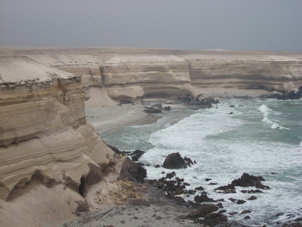
Geologists have a crucial role in studying and analysing the causes, mechanisms and impacts of geohazards. Geologists use their field skills to examine areas, which are prone to earthquakes, volcanic eruptions, landslides, subsidence etc. Their knowledge can be used to generate hazard maps, inform the insurance industry, and help communities adapt to reduce the impact of the hazard.

Geologists play a significant role in modelling the impacts of future climatic conditions and impacts through their research into palaeoclimate. Geologists also have a role in both understanding how climate changes will impact on several key areas, and what can be done to adapt/mitigate/reduce the impacts within these areas - areas such as coastal erosion, flooding, groundwater and geohazards.

Natural resources include things such as precious metals, rare earth metals, base metals, industrial minerals, gemstones, fossil fuels (coal, oil and gas) and construction materials (aggregate, sand, clay, limestone). Geologists have a crucial role in locating, extracting, processing and protecting the natural resources that our economies and lifestyles are reliant on.
Physical infrastructure includes those things needed for society or enterprise to grow and flourish, and the economy to grow. It includes transport networks such as roads, airports and dockyards; energy networks such as power grids; telecommunications networks; solid waste management and water  management. Geologists are involved in investigating the ground conditions, identifying hazards and determining routes and locations to ensure effective and safe design.