Tuesday, 17 May 2011

The Himalayas: Multi-Hazard Case Study

Source: Luca Galuzzi
Following on from last month's post about disaster risk reduction in Nepal, the BBC reports today of the threat of flooding in the Himalayas if earthquakes cause glacial lakes to rupture. As glaciers have melted, and continue to melt, they form lakes. In the event of an earthquake, the large ground accelerations result in these lakes bursting and causing considerable damage to property and infrastructure, as well as loss of life. Further problems can be caused when landslides (including seismically induced landslides) result in large amounts of material falling into lakes and causing them to burst.

This situation is an excellent example of a trigger mechanism (earthquakes, causing landslides, causing flooding) typically occurring in many areas affected by multiple hazards. In areas such as these a separate risk assessment for flooding, a separate risk assessment for landslides and a separate risk assessment for earthquakes will not adequately describe the risk in the area. It would be very easy to underestimate the vulnerability of people, and thus to conclude that the magnitude of risk is much lower than in the real case. Multi-hazard risk assessments would be a much more appropriate tool to understand the complex interaction of hazards in the Himalayan region. These take into account hazards triggering others, vulnerability being increased as a result of one hazard and the cumulative impact of multiple hazards. They try to give a much more 'real-life' view of the natural environment. Multi-hazard research is in a very young stage, yet it is very important and could greatly assist in disaster risk reduction programmes. 

Saturday, 14 May 2011

Earthquake Prediction and Disaster Risk Reduction

Exposed Fault Line (Greece)
After 'what type of rock is this?' the question I probably get asked most as a geologist is 'can we or will we ever be able to predict earthquakes?' Accurate earthquake prediction is considered one of the 'holy grails' of the geosciences. It remains elusive however, and is likely to be elusive for the foreseeable future.

Earthquakes are triggered when stress builds up on these fault lines, as the stress overcomes a critical value the fault ruptures, releasing this stress (or transferring it to other parts of the fault). This release of stress generates seismic waves which shake the ground. Earthquakes cause considerable damage and loss of life across the globe - seen recently in places as diverse as Spain, Japan, New Zealand, Burma, Chile and Haiti. 

Major Plate Boundaries
Geoscientists have a good idea of roughly where earthquakes are likely to happen (although new fault lines are still being discovered). They have an indication of the maximum magnitude we can expect in certain places (though again, there can be surprises, such as the March 2011 earthquake in Japan). Studies of palaeoseismology (historical earthquakes) can also give us an indication of what time frames to expect between large earthquakes. Despite this knowledge and ability to understand these factors - geoscientists have no way to predict exactly when, where and how big a particular earthquake will be. 

Research is examining possible methods of earthquake prediction, including study of animal behaviour and study of electrical disturbances in our atmosphere. This research is a long way away, however, from giving us the vital information we need for earthquake prediction, and current opinion remains uncertain as to whether it will eventually help. 

Bendandi (Source: Luca Lorenzi)
Despite geologists stating that earthquake prediction is a distant dream - predictions are occasionally mentioned, such as the May 11th 2011 Rome earthquake. Rumours had circulated that a dead seismologist (Raffaele Bendandi, pictured left) had predicted that the city would be destroyed on this date. Rumours which caused widespread panic and thousands to stay away from the city. This situation highlights something that isn't talked about very much - the potential dangers of earthquake prediction. Currently earthquake prediction (with precise days and times etc) mainly causes unfounded panic and distress. It damages economies, and has the potential to lead to people not paying attention to genuine warnings and evacuation orders. Even if we do get into a situation where we can predict earthquakes using scientific monitoring techniques, there is of course the potential that those predictions will be wrong. The potential for panic, damage and reluctance to pay attention to genuine warnings means that distributing these warnings must be carefully considered. Earthquake prediction also places a huge burden on local, national and international governments to ensure they can manage and finance evacuations, as well as effectively mobilising communities. While this isn't a danger to, or reason not to predict - it does mean international governments and agencies must be ready to step in and support struggling countries.

Finally, while we cannot (and may not ever) predict earthquakes in the sense of specific location, magnitude and time - we do have a wealth of scientific and technical knowledge about how earthquakes behave, how soils and rock respond to seismic waves, how buildings respond... not to mention many locations prone to earthquakes, and significant historical records giving us an indication of time intervals and magnitude of earthquakes. The huge amounts of scientific data and technical knowledge we have means that we can develop effective disaster risk reduction methods. Earthquakes, and other natural hazards, only become natural disasters when there is risk and vulnerability. If this vulnerability can be reduced, and resilience increased then the impacts of hazards such as earthquakes will be dramatically reduced. The types of things that can be implemented to ensure risk is reduced are things such as changes to urban planning - ensuring that cities are built with stricter building codes, more organisation and planning, and better assigned routes for evacuation and emergency vehicles. This is particularly important in developing countries, where rapid urbanisation in vulnerable areas could lead to potential mega-disasters. Other things such as education and drills, ensuring that people know what to do and how to do it, is crucial. This can be particularly important in institutions such as schools and health centres.

So while earthquake prediction is widely considered the 'holy grail' of the geosciences - we mustn't deflect from the importance of what we can already do. We have the ability to significantly reduce the impacts of disasters - and must work to ensure disaster risk reduction is incorporated into policy, well financed and given our full backing.   

Read more:

Newswatch: Geohazards

To end the week in which the Global Platform on Disaster Risk Reduction took place in Geneva, here is a collection of interesting news stories from around the web relating to geohazards, disaster risk reduction and international development:

Research suggests that the risk of tsunamis in coastal towns close to strike-slip faults is higher than previously thought. A strike-slip fault (where two plates move alongside each other) does not generally cause vertical displacement (associated with the generation of tsunamis), however research suggests they can trigger submarine landslides leading to a higher tsunami risk. Cities this research could have implications for include Kingston (Jamaica), Istanbul (Turkey) and Port au Prince (Haiti).

Research suggests that the possibility of a large earthquake in the eastern Andes is much higher than previously thought. Hazard assessments had previously put the expected maximum magnitude at 7.5, but it is now previously thought to extend to M8.9. The implications of this are significant, as there are millions living in the region (especially the city of Santa Cruz, Bolivia) in poor infrastructure, with inadequate building standards in place.

Staying on the theme of South America, research revealed at the end of last year indicates that if temperatures rise by 1.5-2°C, parts of Peru and Bolivia will become almost desert like. Palaeoclimate research, analysing fossilised pollen within lake sediments, suggests that almost 85% of Lake Titicaca dried up in the past due to evaporation and higher temperatures. This palaeoclimate research gives us an important indication as to the effects of climate change, and how communities need to adapt to increase their resilience.

Reuters reports the results of research suggesting sea level rises could be much larger than previously expected… reaching 1.6m by 2100. This higher value is based on observations of quickening climate change in the Arctic and Greenland’s ice melting. The implications of this would include large scale flooding of low-lying and coastal areas. Developing nations such as Bangladesh and many Pacific islands would be particularly vulnerable, in addition to more developed countries such as China and the UK. To see the implications of sea-level rise around the world, check out this clever map made using Google Earth and NASA data. This is set to a conservative 1m sea-level rise, but you can also adjust this to 2, 3, 4m etc.

Finally, the BBC reports that the UK has taken over the Chair of the International Charter on Space and Major Disasters for the next six months. This organisation is responsible for taking satellite images when there is a natural disaster. These satellite maps can be vital to planning emergency response, giving a clear indication of the level of damage, possible evacuation/emergency supply routes etc. The Charter has been used 12 times already in 2011, providing photos for the Japan earthquake and tsunami, as well as a range of other disasters.

Wednesday, 11 May 2011

Global Platform 2011 - Why is DFID ending aid to the UNISDR?


Earlier this year, DFID announced the results of two major aid reviews. The first, at the start of March, was the UK Aid and Multilateral Aid Review. The second, at the end of March, was the Humanitarian Emergency Response Review (HERR), conducted by Lord Paddy Ashdown. One of the key findings of the HERR was the importance of making disaster risk reduction (DRR) an intrical part of DFID's work, increasing anticipation, resilience and innovation. These are tasks in which geologists have the potential to play an important role. The HERR, interestingly, came after DFID announced earlier that month that they were ending their contributions to the United Nations International Strategy for Disaster Reduction.

The core mandate of the UNISDR, as stated on their website, is to serve as the focal point in the United Nations system for the coordination of disaster reduction and to ensure synergies among disaster reduction activities. The UNISDR main work includes:
- COORDINATING and sustaining partnerships to build disaster resilience and promote disaster risk reduction.
- CAMPAIGNING to build awareness of disaster risk reduction and reduce communities vulnerability to the impact of hazards.
- ADVOCATING for greater investment in disaster risk reduction
- INFORM and connect people by providing practical services and tools.
DFID's justification for the decision to end funding was based upon an assessment of value for money, effectiveness, results, leadership and accountability. In the Multilateral Aid Review, it states:

"UNISDR has not performed its international co-ordination role well. Other more effective institutions such as UNDP and GFDRR are judged to provide better value for money and DFID will increase its funding to them. UNDP is central to the delivery of the MDGs and is at the heart of the UN development system and currently plays an important co-ordination role on disaster risk reduction at the national level. GFDRR is more effective at mainstreaming DRR and climate change adaptation in country development strategies.

The UK will still be a member of UNISDR as it is part of the UN Secretariat, but DFID will no longer provide additional voluntary funding. This funding averaged £0.9m between 2002 and 2010."

However, in light of the HERR, was this the right decision to make? I recently came across an interesting article by Dr Tom Mitchell, who works at the Overseas Development Institute, which discusses the possible reasons behind DFID's decision. In the article, Dr Tom Mitchell suggests a number of reasons for this decision, labelling them as either wrong, very unlikely or very likely. The suggested reasons include things such as... was it very expensive to the taxpayer, is DRR not a priority for DFID, is there a better organisation to take its place or is DFID following a global trend in ending funding - all of these were labelled very unlikely or wrong. The reasons labelled as likely are more related to the appearance of a 'co-ordinating agency' in an era of results and weaknesses in the Multilateral Aid Review process. Dr Tom Mitchell concludes with an assessment that this was the wrong decision, and a hope that the HERR will stimulate a rethink.

So these are the two sides of this debate, and I'm sure there are many other points that others could contribute to this discussion. Dr Tom Mitchell states that many in the field would recognise that the UNISDR has considerable shortcomings - so it seems clear that there is a need for reform and improvements, the key question is whether DFID short be withdrawing its funding, and whether that decision should have been made before the HERR? Disaster risk reduction needs to be a central part of the UK's development programme - its results are not always obvious, until after a disaster happens, but it has the potential to make a significant difference - it is preventative, rather than a cure... and that surely must be an important part of global development.

Any thoughts, comments, feedback very welcome.

Monday, 9 May 2011

Global Platform 2011 - Developing a Global Hazard Database

The Guardian's 'Bright Idea' section has an interview with volcanologist, Bill McGuire from the Benfield UCL Hazard Research Centre in London, discussing the possibility of developing a global databank or central information source on natural hazards/disasters that could be used by world governments. A central information source or global databank would give details of all major natural threats. This wealth of data would be stored, updated and evaluated on a regular basis. It would be accessible by governments and other stakeholders, giving them information and details on events that could threaten particular cities.

There is a real need for excellent communication between all stakeholders in the area of disaster risk reduction. Natural disasters are complex events, combining some or all of interactions between ground conditions, geology, atmospheric dynamics, urban planning, education, public communication and many other factors. Developing appropriate disaster risk reduction schemes, increasing resilience and reducing vulnerability partly relies on excellent communication between experts in these and many other areas. A paper was published about a year prior to the earthquake in Haiti, suggesting that there was a significant threat of a major earthquake affecting the area - but this information failed to be communicated to or acted upon by the emergency planners, and an adequate risk reduction plan was not implemented.
Port au Prince, Haiti
This is, in theory, where the global databank would be useful. With respect to geological and geotechnical data... it would collate data, be regularly updated and evaluated - and made easily accessible to stakeholders. At the moment information is published in numerous journals, by government agencies and geological surveys, and disseminated by universities, conferences and online blogs. A central place that brings all this information together would theoretically help people assess the risk and act upon the science.

There are however a number of questions that need to be addressed...

(1) How is this Data Reviewed?
Data in this database would have to be monitored and reviewed, in the same way information in academic journals is reviewed. The huge amounts of data to be inputted, and huge numbers of authors and contributors means that the review process could be very difficult. Would the simplest solution be a databank where people are free to upload and edit (in a wikipedia fashion)?

(2) Accessibility of Data
The data needs to be contributed in a way in which it is easily understandable and usable by people from a variety of backgrounds. Details of ground conditions need to be communicated clearly to urban planners, and details of seismic probability communicated to emergency planners etc. The databank can not simply be an online archive of academic papers and journals (although this could form a part of it). Some work will have to be done on understanding the best way to communicate this knowledge so that it can be used to its full effect.

(3) Ensuring Communication of Data
It is stated that a paper was published a year before the disaster in Haiti, and was either not communicated to emergency planners or not acted upon by them. It is not altogether clear how this databank would prevent that happening again. The databank would depend on the paper being uploaded, accessed and understood by those with responsibility for emergency planning in Haiti and then acted upon. In my mind, the break-up in communication that occurred in the actual scenario is just as likely to occur in the scenario in which a global databank exists. If a researcher concludes that there is a real risk of an earthquake in a particular part of the world, they have a responsibility to disseminate that information to key stakeholders, and those receiving the information have a responsibility to act upon it. In both the situation with a global database and without a global database the same failures could potentially occur.

(4) Developed vs Developing Countries
Finally, it is unclear what impact this would have on reducing disasters in developing countries. There is the initial problem that it costs money to mitigate against a disaster. I would also imagine that the data available for many developing countries (disproportionately affected by natural disasters due to poverty increasing vulnerability) is significantly less than the data available for developed countries. It is intuitive that countries with a higher GDP can expect to invest more in research and development, have more and better established universities conducting research, and have collected data over a longer time frame. Geological and geotechnical maps, for example, exist to a high level of detail for many of the world's large cities in developing countries. In developing countries, this crucial data is often readily available for large scale areas, but not the small scale needed to understand differential ground motion in an earthquake, for example.

Thus, if urban planning and building resilience are to occur in the developing megacities - an investment in good and detailed ground investigation, slope stability assessments etc is crucial. This investment in gathering information as much as collating existing information will be beneficial to disaster risk reduction in developing countries.

In conclusion, the development of a global databank for natural hazards is an idea worth considering. It could help improve disaster risk reduction in some areas, although as McGuire himself recognises - there are many cases where it would not have made any difference (where there was no pre-existing knowledge of fault lines etc). It is also susceptible to the same breakdowns in communication as exist currently and likely to highlight the lack of information available for some of the most impoverished, and at risk communities. This lack of information is an issue that must be addressed in order to support disaster risk reduction in developing countries, as well as the improvement of communication between stakeholders . 

Saturday, 7 May 2011

Global Platform 2011 - Introduction

Tomorrow sees the start of the Global Platform for Disaster Reduction 2011, in Geneva, and hosted by the United Nations International Strategy for Disaster Reduction (UNISDR). The biennial conference will gather policymakers, stakeholders, reconstruction experts from a wide range of fields including the public and private sectors, NGOs and academia. Over the next few days, as the conference takes place in Geneva, this blog will focus on this important theme. It's a theme in which geologists play a crucial role, and have a huge responsibility for ensuring the information they gather is effectively communicated to other stakeholders. At a time in which we've seen devastating earthquakes, from Haiti to Japan, Chile to New Zealand, the importance of building resilience to natural hazards and reducing vulnerability is more stark than ever. 

The video below is a trailer produced by the UNISDR, highlighting the conference starting tomorrow, you can download the key discussion material here.

Friday, 6 May 2011

Applying Technologies from Developed to Developing Countries

While there is a significant need for geologists to engage with international development, there's also a tremendous importance in developing tools, skills and technology in developed countries. In many situations, businesses, universities and governments of developed countries are willing to invest significant amounts of money in developing technologies and tools. This investment can often not be matched by many developing countries, but the technologies developed could eventually have a global use and be of benefit to millions in poverty. 

For example, the intrusion of saltwater into freshwater aquifers is a global problem, and a problem likely to increase if and when sea-levels rise, and coastal cities grow. Developing the technology to monitor and control this influx will require investment, research and development - and yet the outcome could be a relatively cheap technology that can be used globally. Coastal aquifers in the UK and Tanzania could equally benefit from similar technology.

Typical Coastal Aquifer (From: USGS)

A further example was published in the New York Times today, analysing the most and least safe cities affected by a number of natural hazards (including weather events such as tornadoes, hurricanes, hail and storms, floods and droughts, and earthquakes). The study gives an 'overall risk' map combining these events, and separate maps for hurricanes, tornadoes and earthquakes. Little information is given on how the 'overall risk' map was generated... the individual maps were generated using historical data and assessments from the USGS. The lack of description and methodology means it is hard to critically analyse the data within this multi-hazard risk assessment, and how it has been compiled. The development of software tools and methodologies for developed countries with a high risk of damage by multi-hazards (e.g. Japan, USA, China etc) could be extremely useful for developing countries which also suffer from a range of natural disasters such as landslides, floods, droughts, earthquakes (e.g. Nepal, Uganda etc).


Source: New York Times

Tuesday, 3 May 2011

Photos: Surveying for a Shallow Well

Initial Reconnaisance - examining the general location of the village, soil & rock exposures, existing water sources etc   


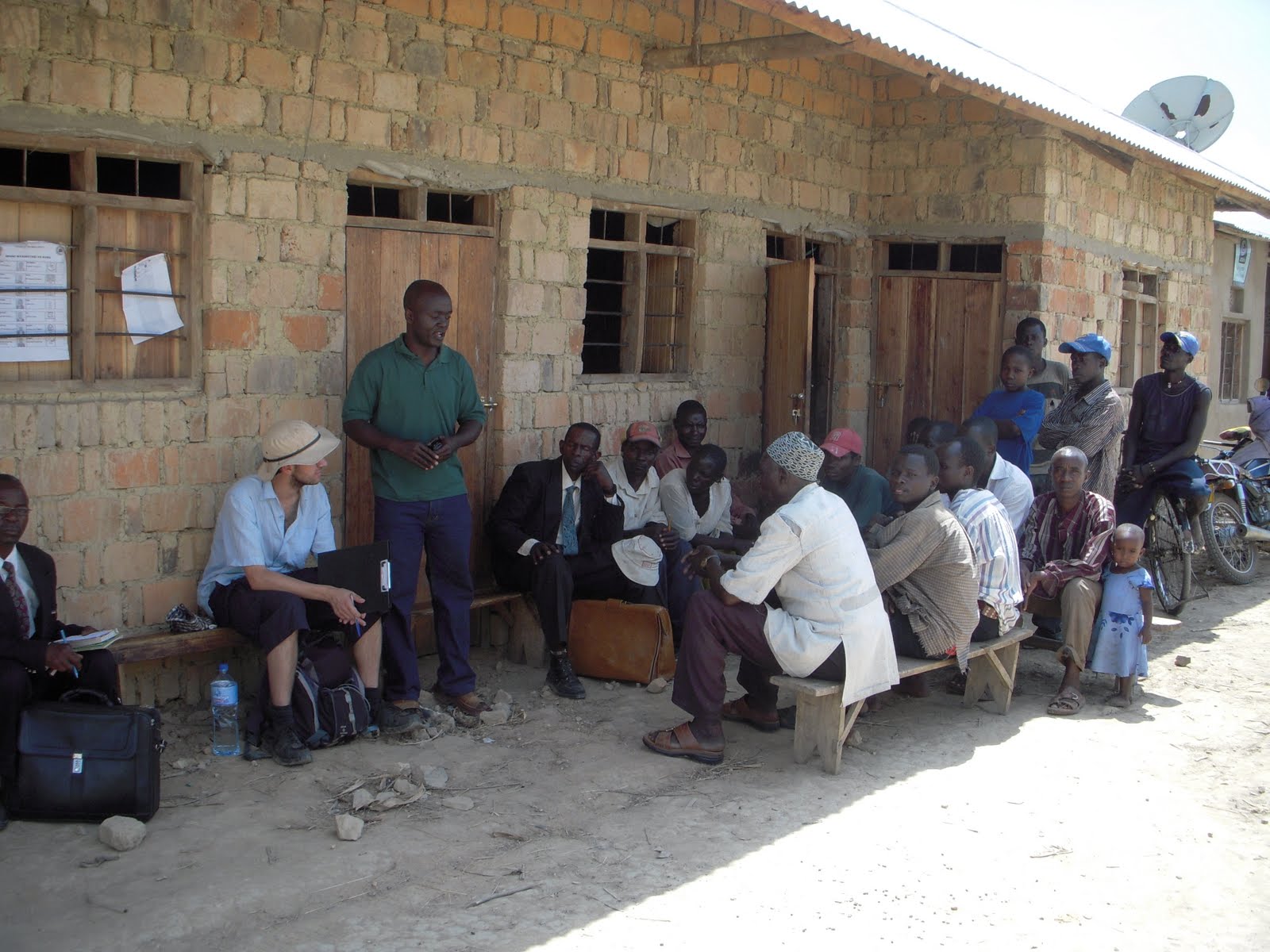
Discussion - An important part of the surveying process is to talk with people in the village to get their views and opinions, learn from them, ask for their help, support and contributions to the project.

Hand Auger - Augering down through the ground, to examine the soil structure.


Examination of the soil to assess its properties (such as permeability etc),

1.5m of soil, into low permeability clays. In this location the clay persisted for several metres making the site unsuitable for a shallow well.

Thursday, 21 April 2011

Monday, 18 April 2011

Resources: The Guardian Newspaper

The Guardian newspaper have, online, a number of helpful resources relating to geology and international development.

The Guardian gather many resources relating to global development in these pages including news, blogs, case studies and opinions. The pages are funded, in part, by the Bill & Melinda Gates Foundation and aim to create a forum for debate as well as promoting the sharing of ideas and research.

The 'Poverty Matters' Blog is a blog covering a wide variety of topics relating to global development - and with a number of authors ranging from NGOs to Government Ministers. Space for comments allows for discussion and debate.

These pages offer the reader news and reports covering natural hazards and extreme weather events across the globe. Photos, interactive science reports (e.g. volcanology, earthquakes etc) and links to blog articles make this a useful resource.

Friday, 15 April 2011

Case Study: Disaster Risk Reduction - Nepal

The Guardian 'Poverty Matters' blog, focusing on global development, published an article by Alan Duncan today (Minister of State for International Development, UK) in which he highlights the importance of Disaster Risk Reduction in the Asian country of Nepal.

A) GEOLOGICAL & HAZARD CONTEXT

Nepal, situated north of India - in the Himalayas, is located in the collision zone of the Indian Plate with the  Eurasian Plate (right centre in diagram below). This results in a very high risk of earthquakes, with an estimated 10,000 people killed as a result of seismic activity between 1900 and 2008 (NSET-Nepal, 2010). The last major earthquake was in 1934, and palaeoseismology suggests that they occur every 70 years - meaning a major earthquake is due in the region.


In addition to earthquake hazards, Nepal also suffers serious problems from flooding and landslides - both of them resulting in more deaths than earthquakes in the period 1971-2008 (Landslides = 3987, Floods = 2936, Earthquakes = 873, as stated by NSET-Nepal, 2010). 

B) VULNERABILITY

Nepal is very vulnerable to natural hazards, rapid urbanisation - especially in the large city of Kathmandu, with poor spatial planning and disaster management means that communities are very vulnerable to a large earthquake, with a conservative estimate of 40,000 being killed, and many more injured (Asian Disaster Preparedness Centre). The range of hazards that could strike Nepal also complicate the situation. Communities are vulnerable to seismic-induced landslides, water-induced landslides, flooding and other hazards (wildfires etc), with the varied topography being a key factor in this. Poverty in this country increases the vulnerability to disasters. Building to resist earthquakes is expensive, and preparing communities requires investment. 

C) DISASTER RISK REDUCTION

As Alan Duncan states, there is a real need for action to reduce the risk in Nepal, by supporting the Nepalese government to develop their disaster management plans, investing in community education, urban planning resources and other risk reduction methods. As the Nepal Risk Reduction Consortium established by the UN work to support the Nepalese in preparing for disaster, and reducing the impacts of that - it is important to:
1) Ensure excellent communication between all stakeholders, including scientists, engineers, social scientists, town planners, politicians and community representative. 
2) Ensure a sustainable programme is put in place - drawing on community participatory methods to ensure that risk reduction is in place at all levels.
3) Develop multi-hazard risk assessments in order to better understand the complex nature of the hazards 

1. Communication
In order to develop detailed and thorough disaster management plans, and a disaster risk reduction plan, there must be good and detailed communication between stakeholders. Geologists and engineers must communicate with social scientists and urban planners in order to ensure the science is accurate and detailed, and incorporated into their plans and procedures. Communities must be consulted and their experiences and knowledge drawn upon to ensure a sustainable programme and policies (see below). 

2. Sustainability
In order to make disaster risk reduction sustainable there must also be substantial community involvement at every level - from identifying hazards, to educating communities, to determining how communities can build resilience and in writing disaster management plans. My experiences in water & sanitation work show that simply pouring finance and building institutional knowledge will not guarantee success or sustainability - without working with the community, drawing on community knowledge and involving them in the decision making. Community participation builds ownership, a sense of responsibility and community knowledge. In a similar way, if DRR is going to be successful in Nepal it must engage people from all aspects of the community and not be a 'top-down' exercise.


3. Multi Hazard Risk Assessments
There is a real need to develop multi-hazard risk analyses for this area. Single hazard risk assessments (i.e. one for flooding, one for landslides, and one for earthquakes) have the potential to result in increased vulnerability to other hazards - they fail to incorporate the complex interaction of hazards, triggering mechanisms, or the increased vulnerability to one hazard if it follows another hazard. Disaster Management Plans also need to examine wide-ranging factors such as water & sanitation, in order to determine how that will work in a disaster, hopefully preventing epidemics of diseases such as cholera.

Further information on multi-hazard risk assessments (in the context of Japan) can be found in this post.

D) CONCLUSION

As stated in this blog's analysis of the Humanitarian Emergency Response Review by Lord Ashdown, there is a definite need for investment in disaster risk reduction, and it is welcomed that DFID is taking this seriously. However, as outlined above it must be ensured that there is communication at all levels, and that it is sustainable, with community involvement and knowledge being fed into the process. A move to multi-hazard risk assessments is also suggested in order to better understand the complex interactions between hazards, and so improve the response in Nepal to future disasters.

Tuesday, 12 April 2011

Key Themes: Climate Change

The 'Key Themes' posts are a series of short articles outlining the role that geologists have in various aspects of global development.

Research into climate change and its impacts on communities across the world is currently being done by many institutions across the world, and eagerly awaited and examined by NGOs and government agencies. It is perhaps one of the biggest issues in this generation, with huge questions such as - what can we do, and how will it effect us?

Climate Change: Fact or Fiction?

There is significant scientific evidence that suggests that human induced climate change is a reality. There are natural fluctuations in the earth’s climate (leading to ice-ages etc)… however research suggests fairly conclusively that humans are accelerating climate change through the release of various emissions.

The Geological Society of London has released a briefing document outlining the geological evidence; this is aimed at non-specialists as well as geologists. It is available to read here. Geologists play a significant role in understanding past climates, and the patterns that occur over time. This understanding of the past aids the modelling of future climatic conditions and the impact changes may have.

How is climate change related to international development?

It is generally accepted that the carbon-footprints of people in developed countries are significantly greater than the carbon-footprints of people in developing countries. The UN has suggested that the world’s poorest produce a small fraction of the world’s greenhouse gases – as the graph below indicates.

From: http://unstats.un.org/unsd/environment/air_co2_emissions.htm


Yet research also suggests that the effects and impacts of climate change will disproportionately affect the poor – that the poorest are the ones least able to deal with environmental change. Global warming, as well as changing temperatures, will lead to:
·      Higher sea levels and flooding of low-lying coasts
·      Changed patterns of rainfall
·      Increased ocean acidity
·      Decreased oxygen levels in the oceans

Adapting to these effects requires significant investment, well beyond the means of many developing countries. A publication by the Parliamentary Office of Science & Technology (Postnote No. 269, 2006) suggests developing countries would have to deal with the following environmental impacts:
·      Changes in rainfall patterns
·      Increased frequency and severity of floods, droughts, storms and heat waves
·      Changes in growing seasons and regions
·      Changes in water quality and quantity
·      Sea level rises
·      Melting of Glaciers


These impacts are likely to have result in changes to water resources, agriculture, human health, infrastructure, food security, settlements and natural disaster planning.

What role do geologists have to play in this sector?

As previously outlined geologists play a significant role in modelling the impacts of future climatic conditions and impacts through their research into palaeoclimate. Geologists also have a role in both understanding how climate changes will impact on several key areas, and what can be done to adapt/mitigate/reduce the impacts within these areas. A few examples of such key areas are listed below:

Groundwater: As global warming develops, how will this affect supply of groundwater and the quality of groundwater? How will sea-level rises change the salinity of coastal aquifers? The British Geological Survey are undertaking researching into questions such as these, you can read about the likely impact on groundwater supplies in Africa here.

Coastal Flooding & Erosion: Modelling of flooding, as a result of increase in sea levels is being done, as is an examination of how climate change will impact coastal erosion. Both of these can result in a loss of settlement and livelihoods – potentially driving problems in food and water security.

Natural Disasters: The effects of climate change on disasters ranging from floods and droughts, to wildfires and storms, to earthquakes and tsunamis is not altogether understood. Research indicates an increase in the unpredictability of rainfall in terms of intensity and duration – increasing the frequency of extreme droughts and floods. This post, written in February, highlights how historical changing of climate resulted in extremely severe droughts. 


Geologists also have a key role in ensuring that decisions made in this field are made on the basis of good science. A lot of processes are being attributed to climate change with very little or no scientific evidence. Climate change adaptations and work in communities to build resilience should be done on the basis of a thorough understanding of the area and science - otherwise they could increase vulnerability and do more harm than good. Climate change should be put in its proper context, alongside the various other hazards and vulnerabilities that communities face.

Thursday, 7 April 2011

Resources: NASA Earth Observatory

The NASA Earth Observatory website is a good resource for geologists, containing satellite images and reports for a number of natural hazards and other events. The site is free to access, and is updated fairly regularly. There are also daily and weekly e-mails you can subscribe to with information about the current situation with a wide variety of natural hazards.

This site is good for keeping you informed about some of the hazards and disasters that are happening, that haven't made it into the main news reports. For example, at the end of March heavy rains in Thailand led to landslides, together displacing more than two million people, and killing around 53. It is by no means, exhaustive however, with no mention (that I could observe) of the earthquake to strike Burma in late March this year. The site is, however, well worth exploring - and the quality of some of the images it provides is excellent.

Thailand Landslides: http://earthobservatory.nasa.gov/NaturalHazards/view.php?id=49976